Today, I managed to wake up pretty early and headed east via the Keiō Takao line. I had wanted to wake up early since I was planning on hiking Takaosan (Mt. Takao) and wanted to make sure that I would be able to hike up and down well before dark, even if I ended up wanting to hike at a leisurely pace.
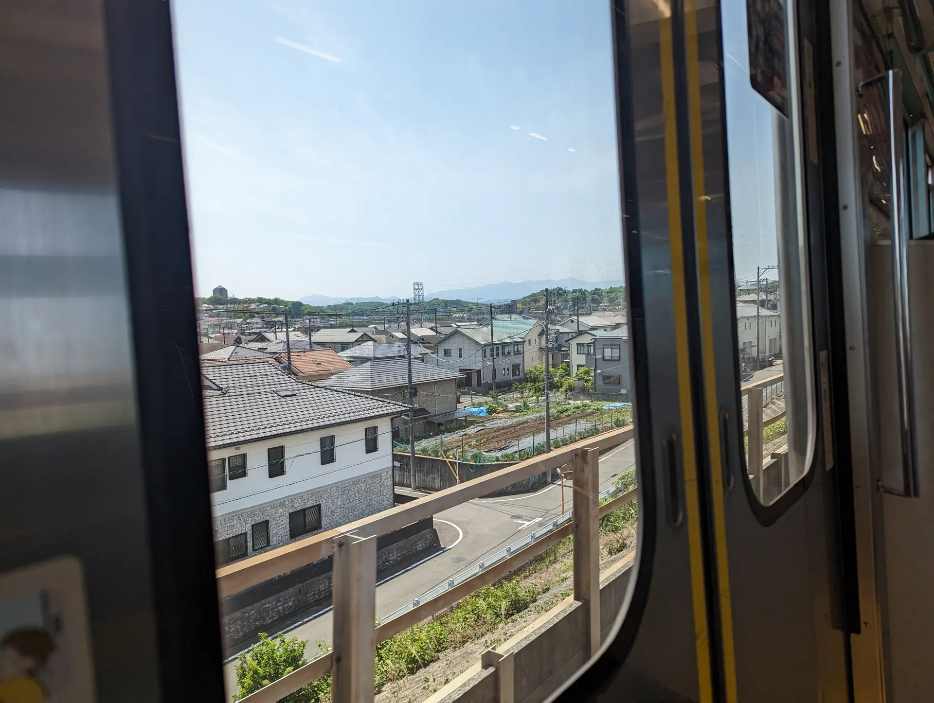
The total trip was about 1.5 hours and multiple transfers, but it wasn't that bad. I luckily did get a seat for the majority of the trip so that was nice. As we got closer to the final stop, Takaosanguchi, I noticed more hikers board and I began to feel a little under-prepared. I hadn't anticipated doing any hiking so I left my boots, backpack, and hiking pants at home. I instead donned my Nikes, drawstring bag, and regular shorts (hopefully there aren't ticks!). I figured my main issue would be me rolling my ankles on the way down or having a sore back from my backpack but a lot of the people on the train were decked out.
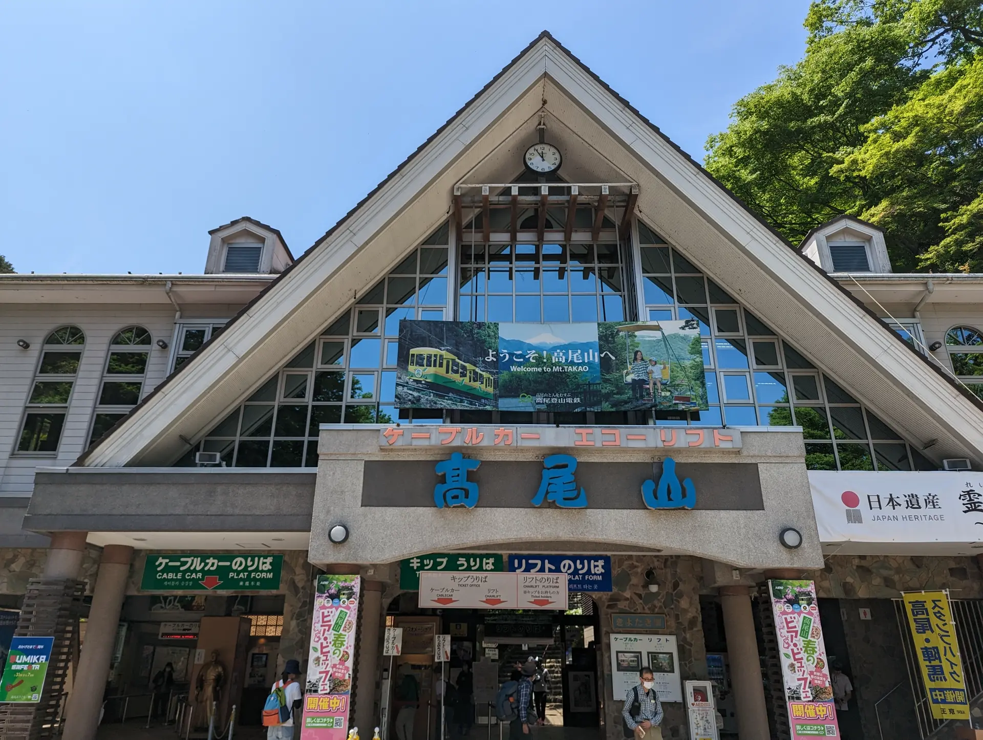
We arrived at the terminal around noon and I could already tell it was going to be a very crowded hike. Swarms of people were making their way to the trailheads and even more were hanging out at the base of the mountain, by the chair lift and cable car. I decided to buy a hat here because I was unsure how shaded the route would be but I think I probably didn't end up really needing it. It might be handy to have as I walk around Tokyo though!
Mt. Takao is pretty popular from what I can tell. The reason I had known about it was actually through an anime, "Encouragement of Climb", in which the main character Aoi gets addicted to hiking and hikes Mt. Takao. It wasn't depicted as busy as I got to see it though! That being said, I don't know if it would be busier or less busy on the weekend since a lot of the traffic that I ended up seeing appeared to be school trips.
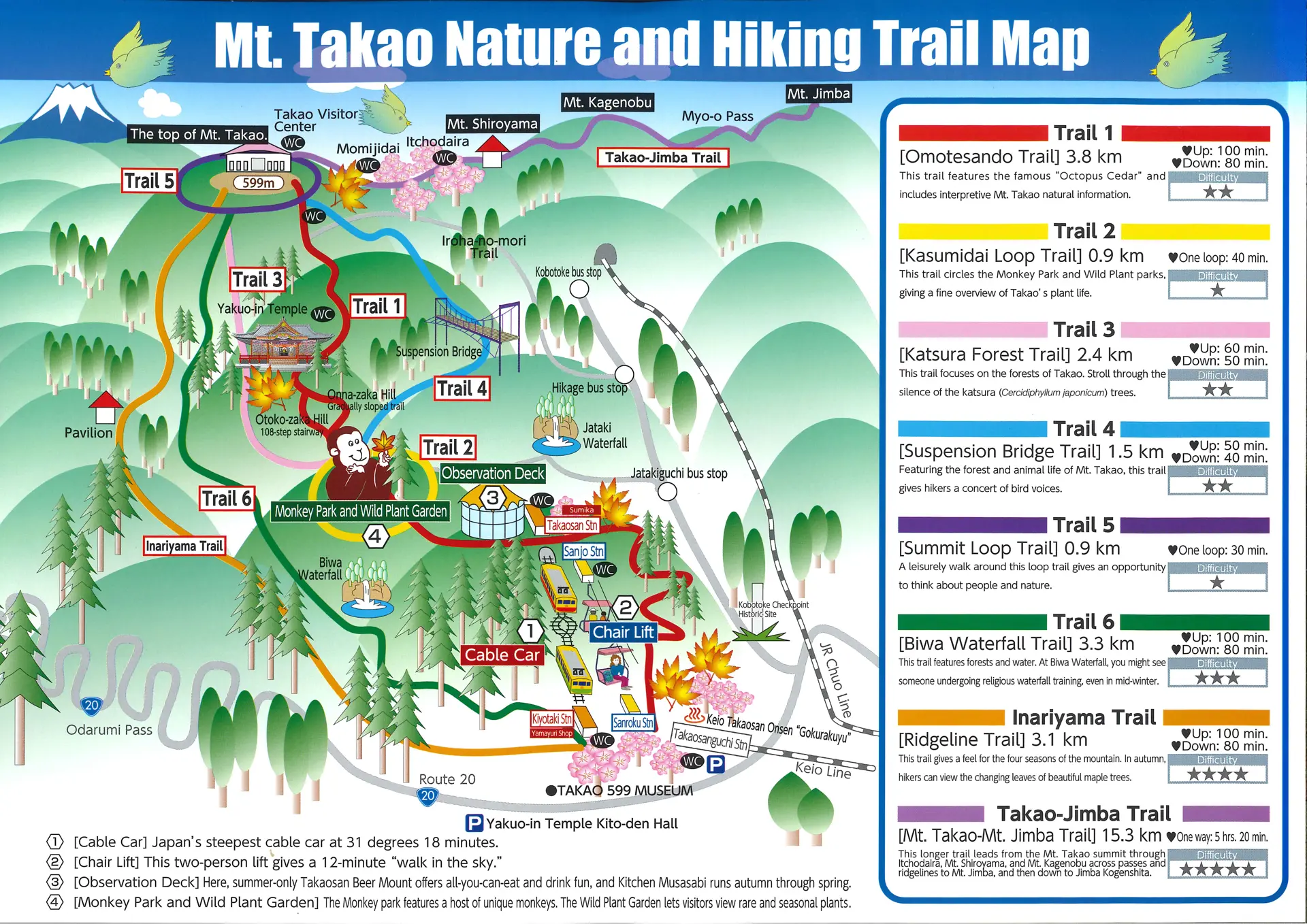
I decided to hike the whole way up instead of taking the cable car or chair lift and decided to pick Route 1 going up since it's the most popular and because there would be interesting places to stop on the way up if I needed a rest.
 Map originally found at takaotozan.co.jp
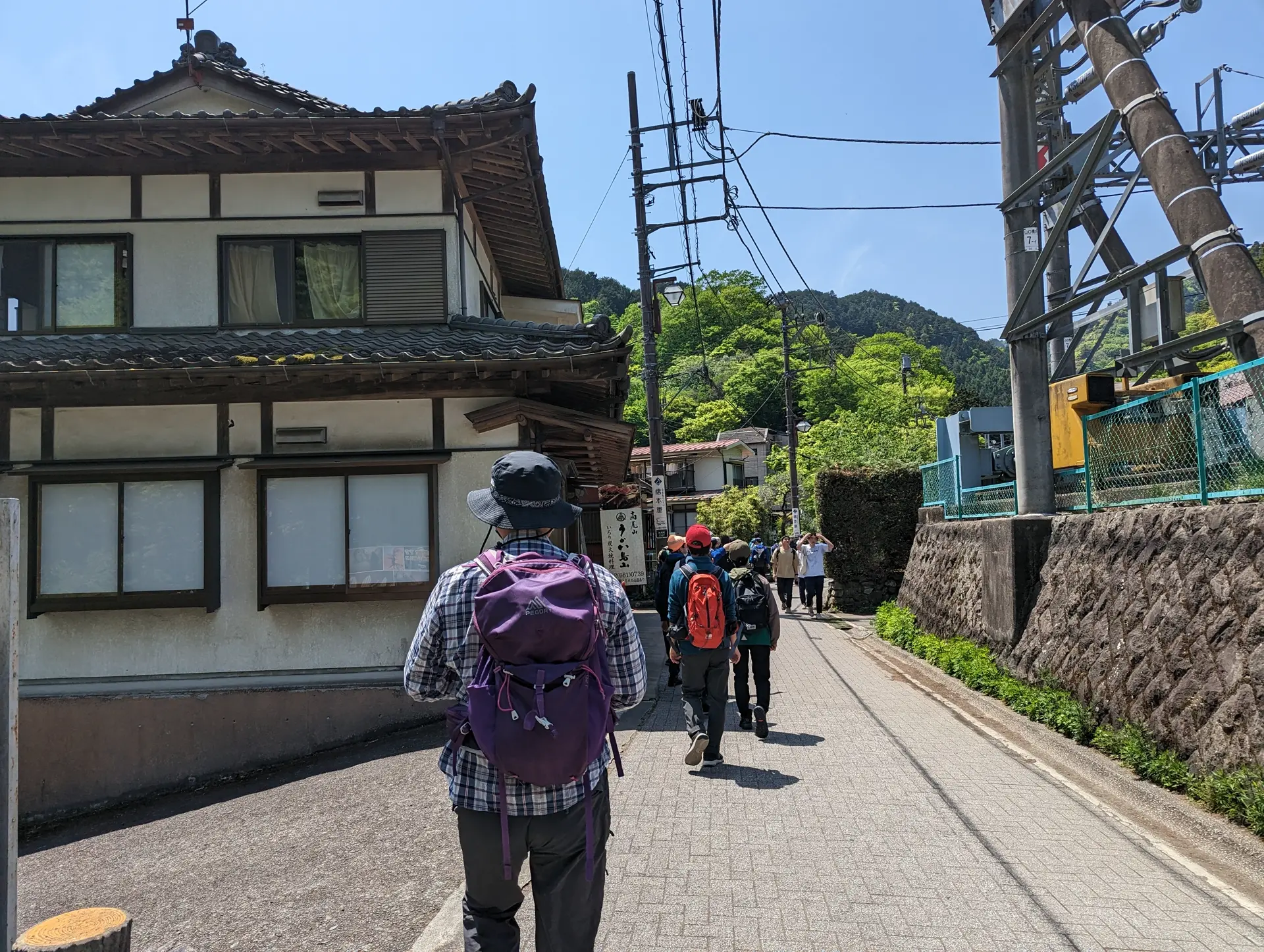
After trying for a few minutes to figure out exactly where to start route 1, I followed some other hikers that seemed like they knew what they were doing and hoped for the best.
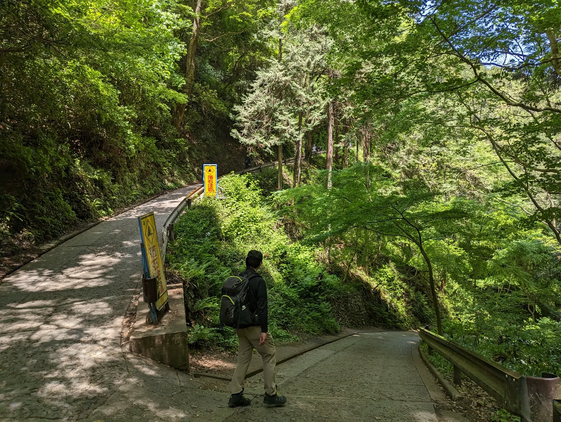
Trail 1 is paved the entire way up to the top of the mountain. The mountain isn't that tall and there is only a bit over 1300 feet of elevation gain for the hike, but I was still surprised that a recreational hiking destination would be fully paved. Some of the trails aren't paved though, and we will get back to that.
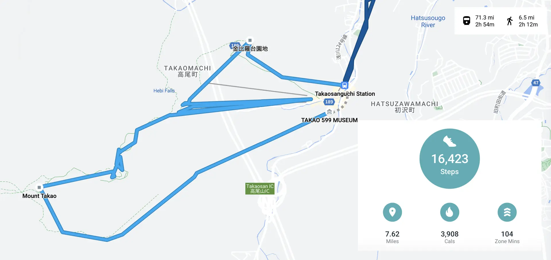
I found that the first part of the hike was the steepest, especially the switch-backs you can see on Route 1 in the map above.
The route map isn't really to scale but apparently the cable car rises 271 meters so by the time Route 1 meets back up with the cable cars, more than half of the vertical distance has been covered (441m elevation gain for the whole hike).
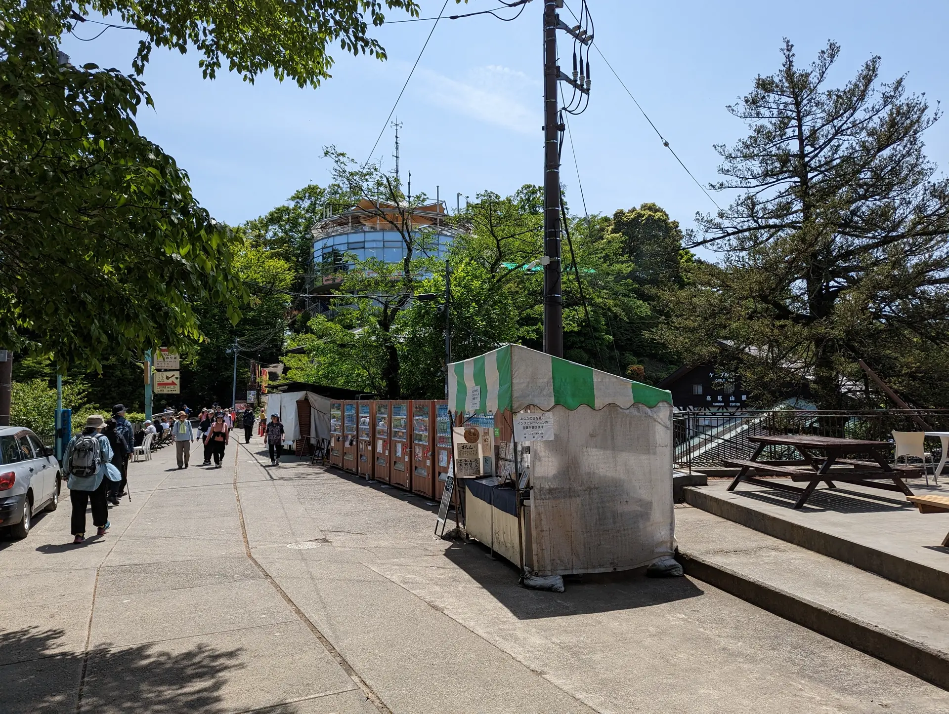
Once you do meet back up with the cable car crowd, you will enter an area full of shops to buy both food and souvenirs. I decided to only get a cheese tart, which I didn't photograph since I inhaled it. It was pretty good and helped replenish my energy, since it was the first thing I had eaten yet today. I looked around for a couple more minutes before setting off again.
There were already some pretty good views from this height, so I was hopeful for the view from the top!
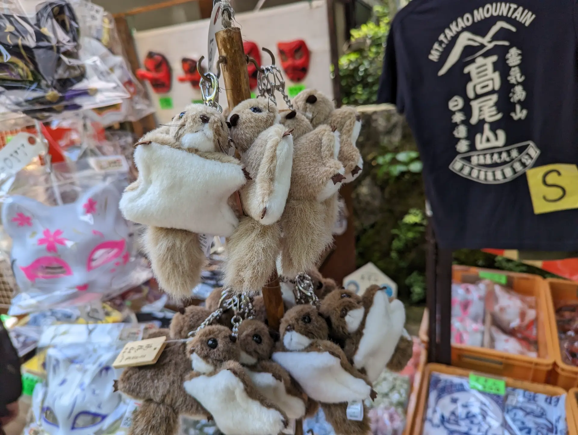
After only a short distance, there were a few more shops selling souvenirs, including one selling the same flying squirrel keychains they bought in Encouragement of Climb, but I decided not to buy one since one was like ¥1,920 or something crazy. I thought it was cute but maybe not $15 cute, you know? They also actually had a poster of Encouragement of Climb's newest season, so I felt validated as an anime watcher. I didn't see any posters for live-action TV shows about visiting Takaosan, so I think we know which is better.
A little while later, there was a split in the path. One side had a massive amount of stairs and the other didn't. I knew there was temple here, Takaosan Yakuōin Yūkiji, and for some reason felt that stairs were more temple-like. I was worried if I took the non-stair path I would miss the temple entirely. Although I could have consulted the map at this point, I chose not to.
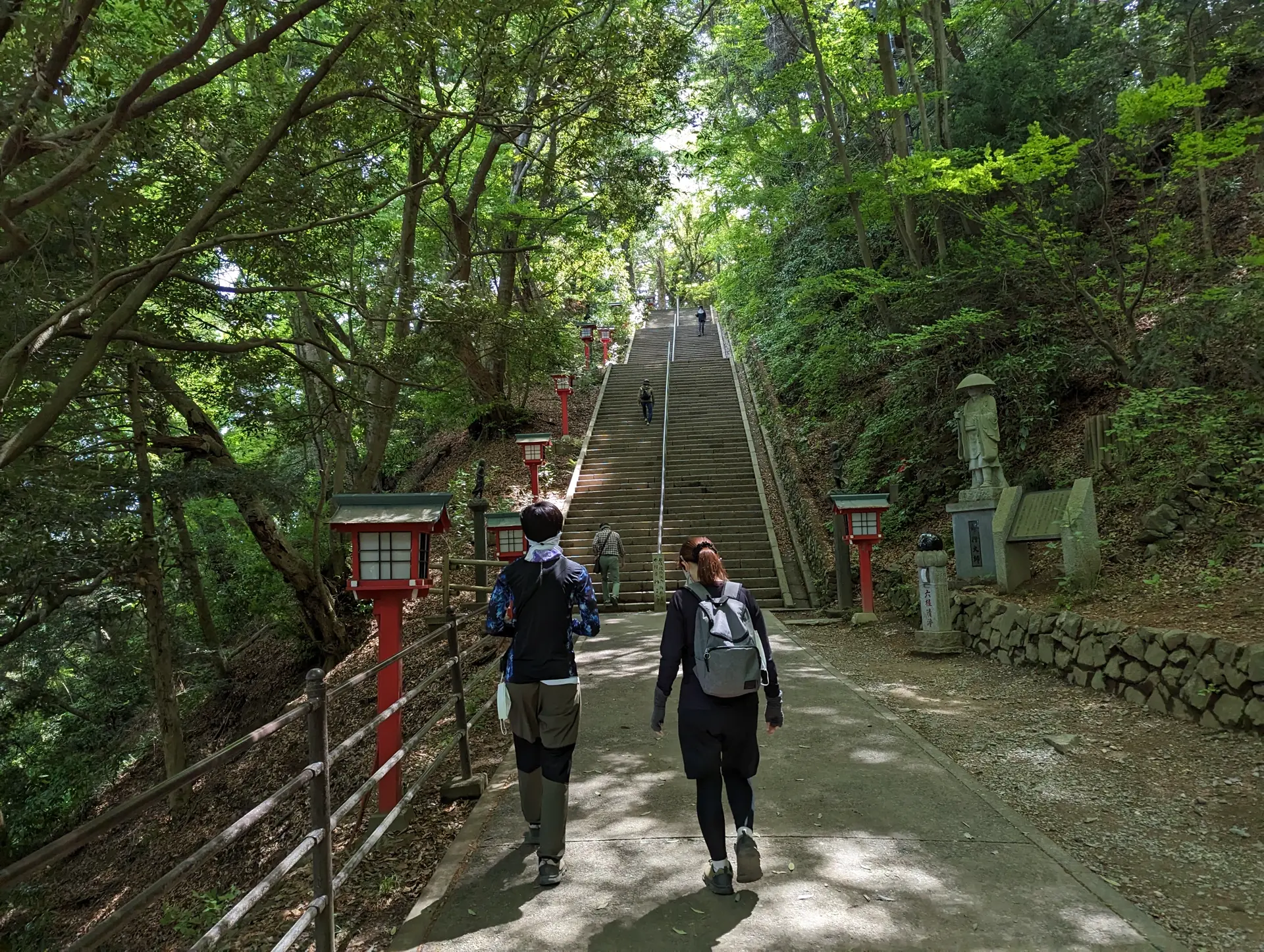
After climbing these stairs I realized quickly enough that the paths met up again before entering the temple at all! I climbed up all 108 steps for nothing!
I later learned that these types of paths have a name, Otokozaka and Onnazaka. I'd recommned checking out that link if you're at all interested in Buddhist concepts behind it or why there are exactly 108 stairs. Anyway, I feel like I made the right choice because the kanji for Otokozaka and Onnazaka, 男坂 and 女坂, literally mean Men and Women's slope. I'm glad I played out gender stereotypes properly I guess. Probably if you visit and aren't super energetic, just take the nice slope instead.
Luckily, after taking the stairs, I was able to pursue instant gratification in the form of dango. Mitarashi dango this time.
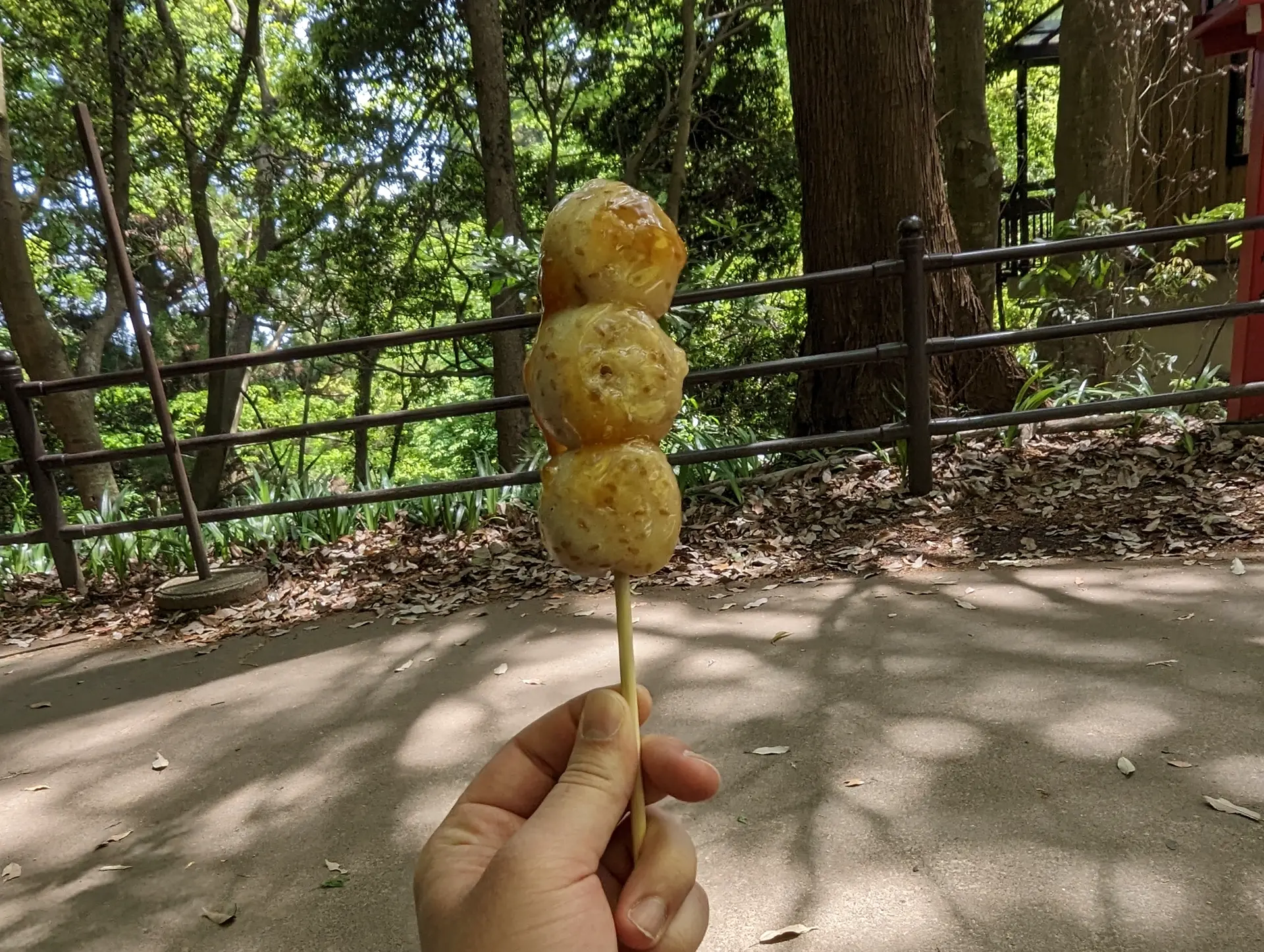
While eating my dango, a kid in probably middle school or high school came to talk to me and asked where I was from. I put on my best American voice as I told him I was from Seattle. He asked something else that I can't remember and thn he turned back to talk to his friends, who seemed pretty impressed with him. Good job kid! When I was done with my dango, I gave them the more stereotypical "Have a nice day!" I could muster, which was returned in kind. Very wholesome.
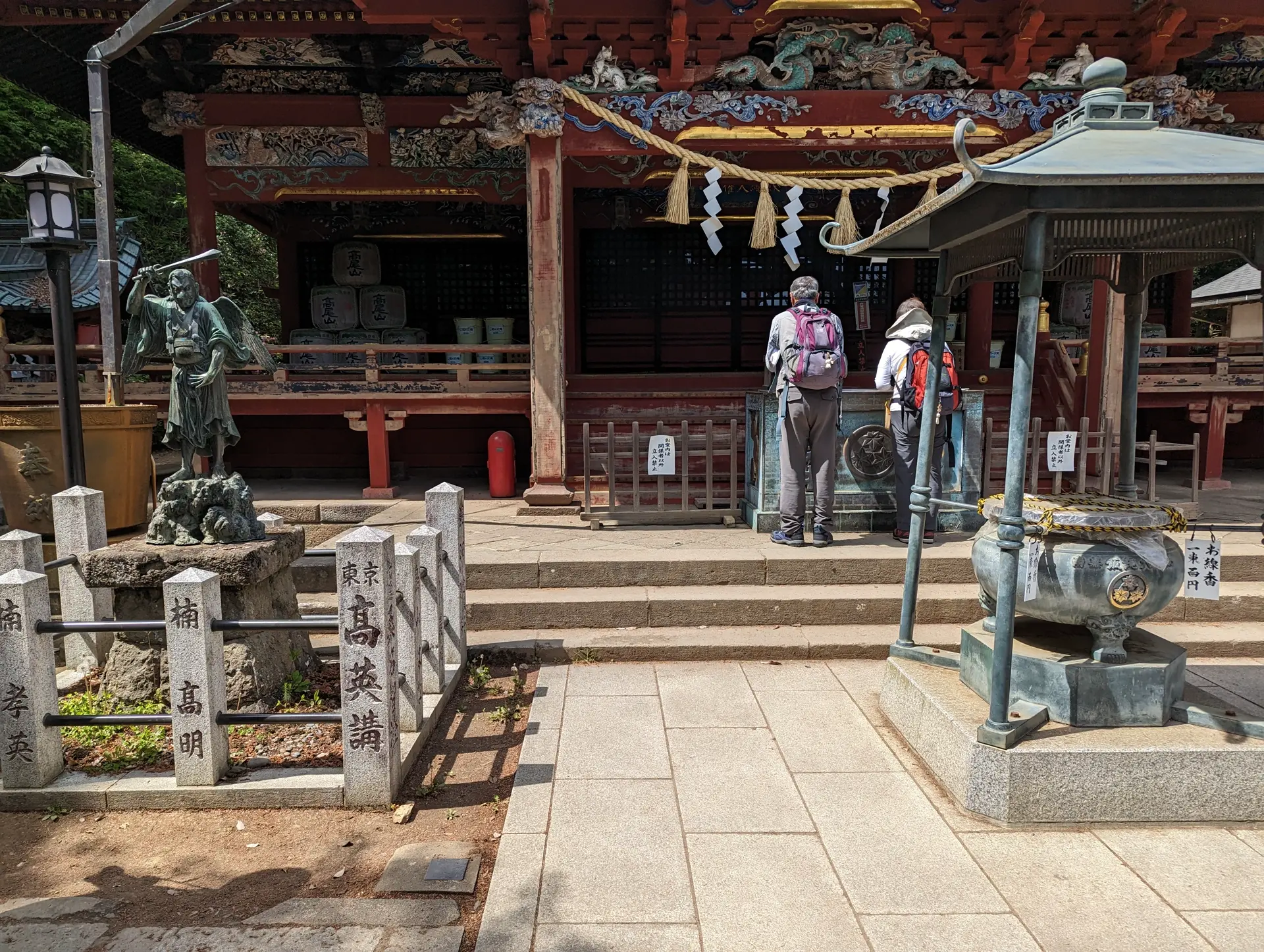
From here, I entered the temple which was bigger than expected. There were the usual places you could draw your fotune or buy charms, but also a stamp rally (I'm pretty sure) and some cool statues.
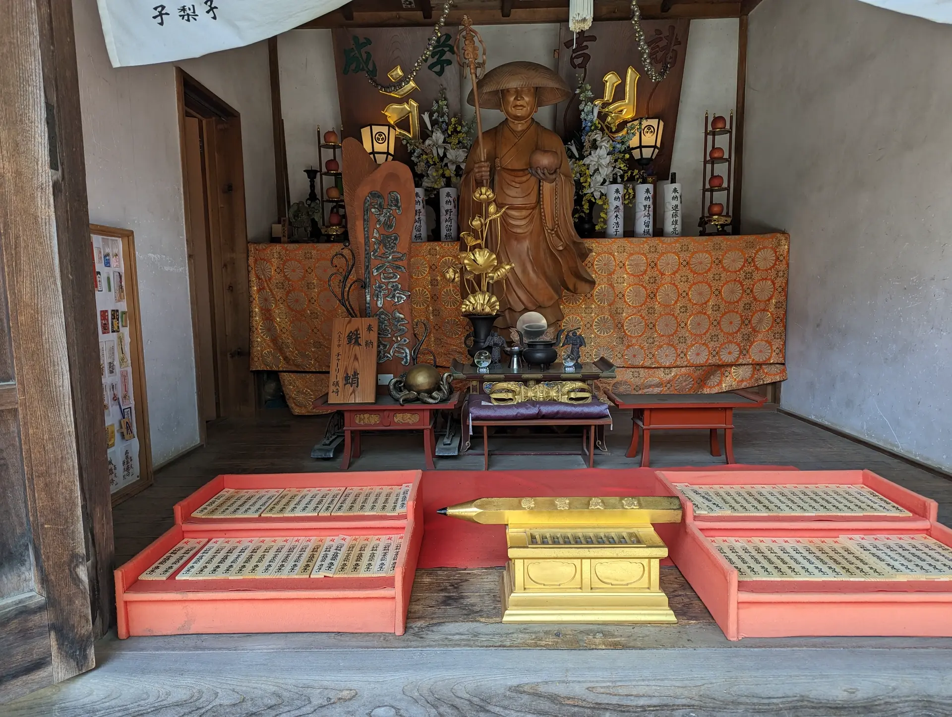 I wonder if this one is for good grades?
I don't actually know how temples or shrines work but there were actually at least 2 of the big buildings with offering boxes and the giant incense burners here.
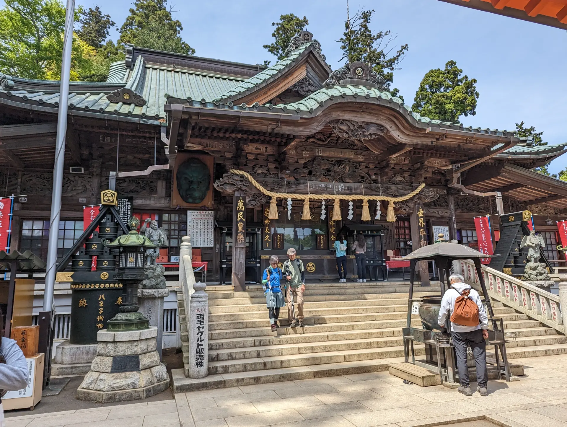
And the second (maybe first IDK!):
I should have spent a little less time here than I did because the path from here to the top of the mountain is a bit narrower so I got stuck in a group going up the rest of the way. It was probably only like 10 minutes though, so not too bad. This part was actually kind of fun because as groups of kids passed each other as one was going up and the other down, they would erupt into bursts of "konnichiwa!" back and forth. When they noticed the blonde people behind me they would turn into "hello"s. About a million "konnichiwa"s later, I had reached the summit.
I had managed to reach the top in like 85 minutes even with 2 stops to eat snacks and browse, so I felt pretty good about it. In the first part I was passing people and a bit worried that I wasn't pacing myself properly, but it worked out in the end. The guide mentioned 100 minutes up and even the in person signs mentioned 90 so I felt pleased with my time with the breaks and considering I was wearing a mask the whole time. Maybe the peloton the past few months helped?
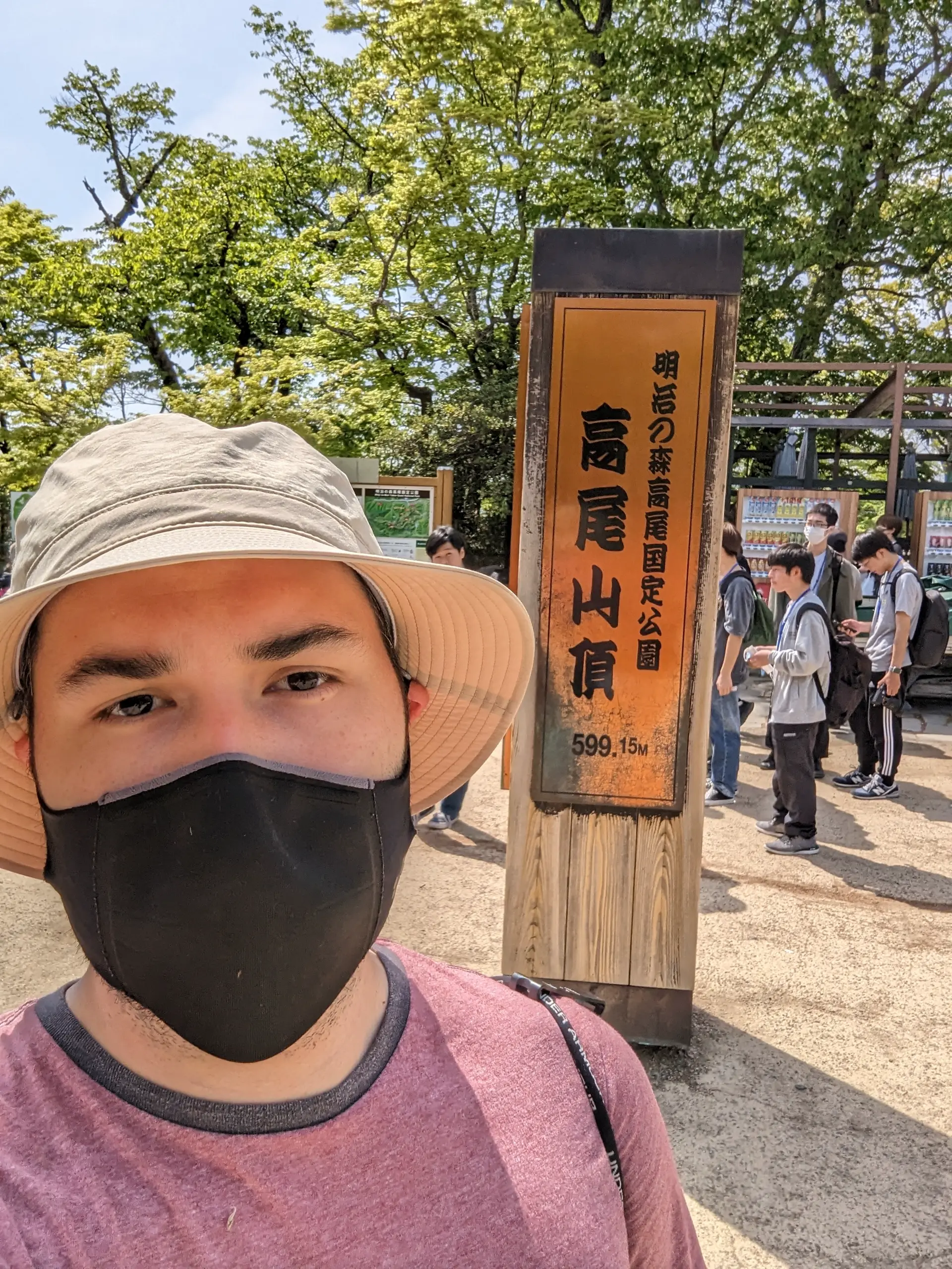
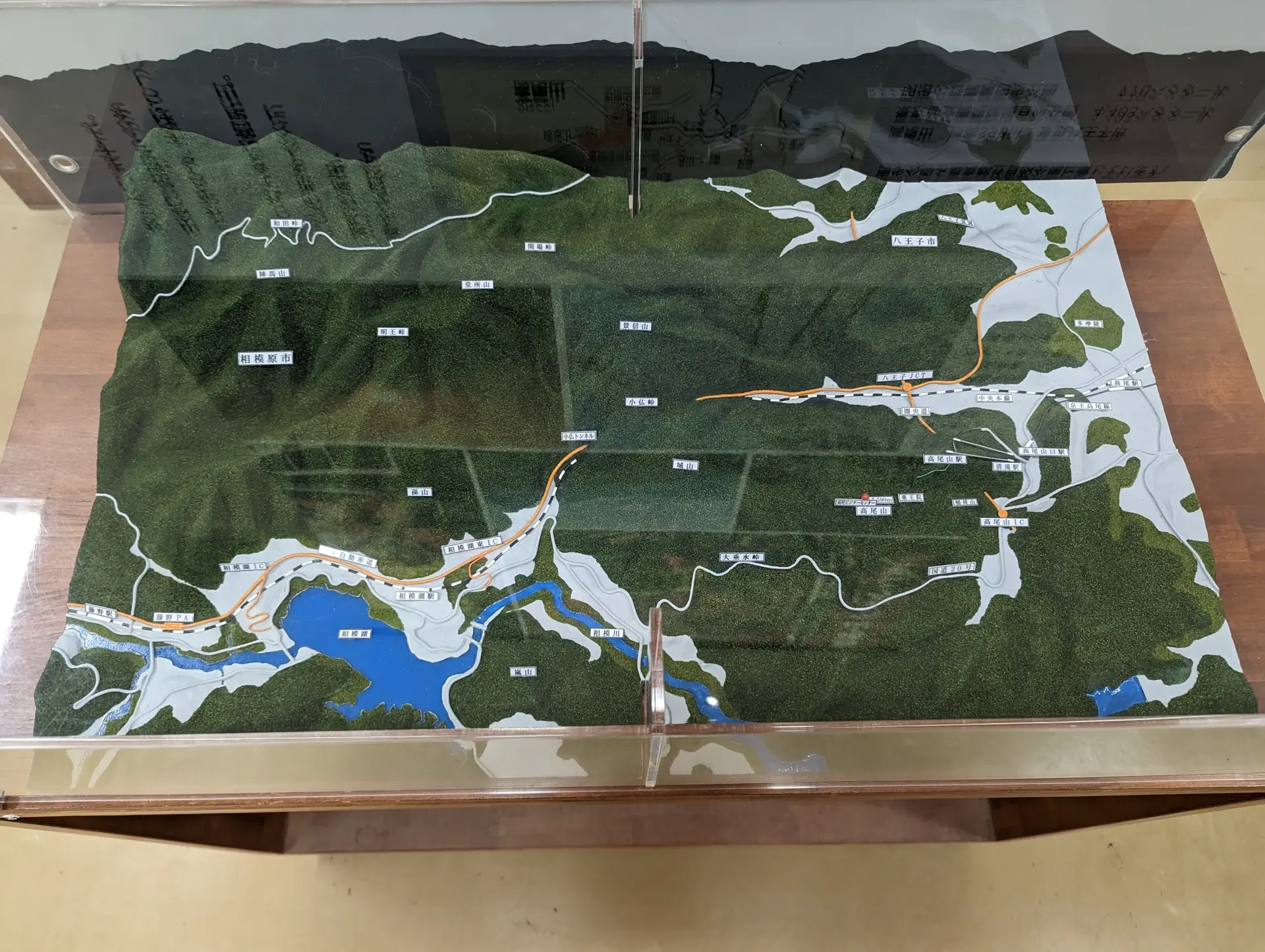
The top of this mountain has tons of infrastructure. Literally more than some small towns. And definitely more public restrooms. I perused through the Takao Visitor Center for a bit and it had some cool stuff, like a nifty miniature map (seems to be kind of popular in Japan)
I also filled out a brief survey to get a cute, free sticker!
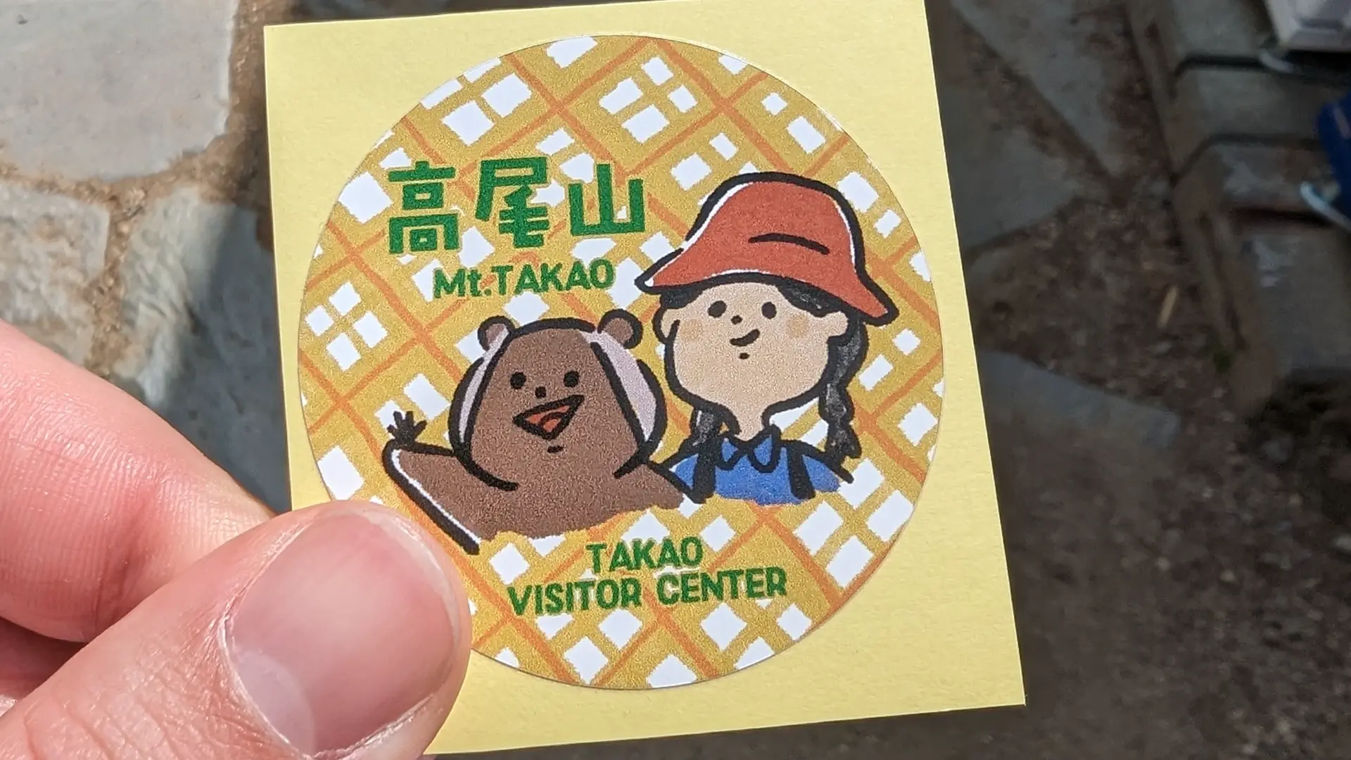 What animal even is this? A flying squirrel and a... what?
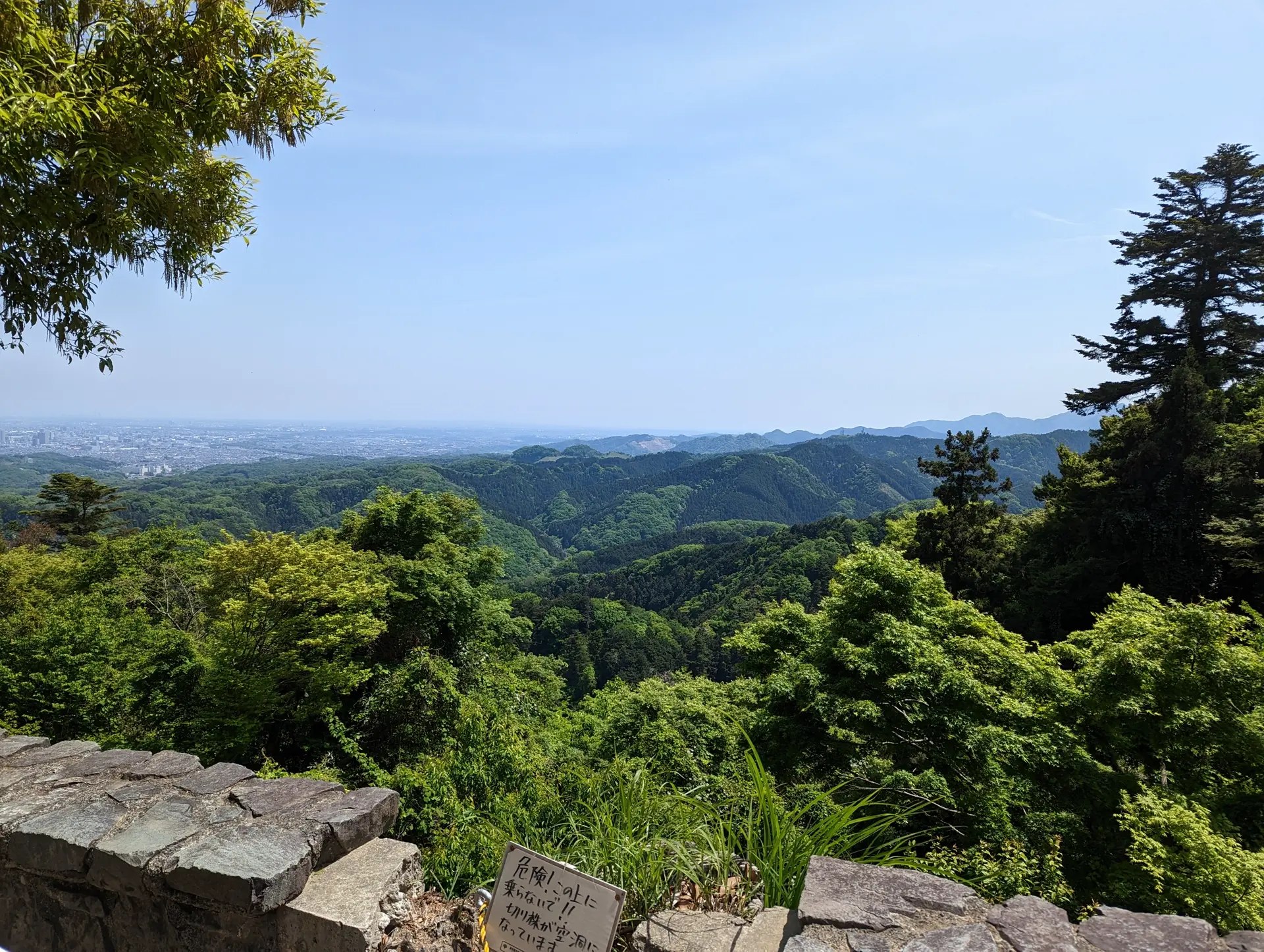
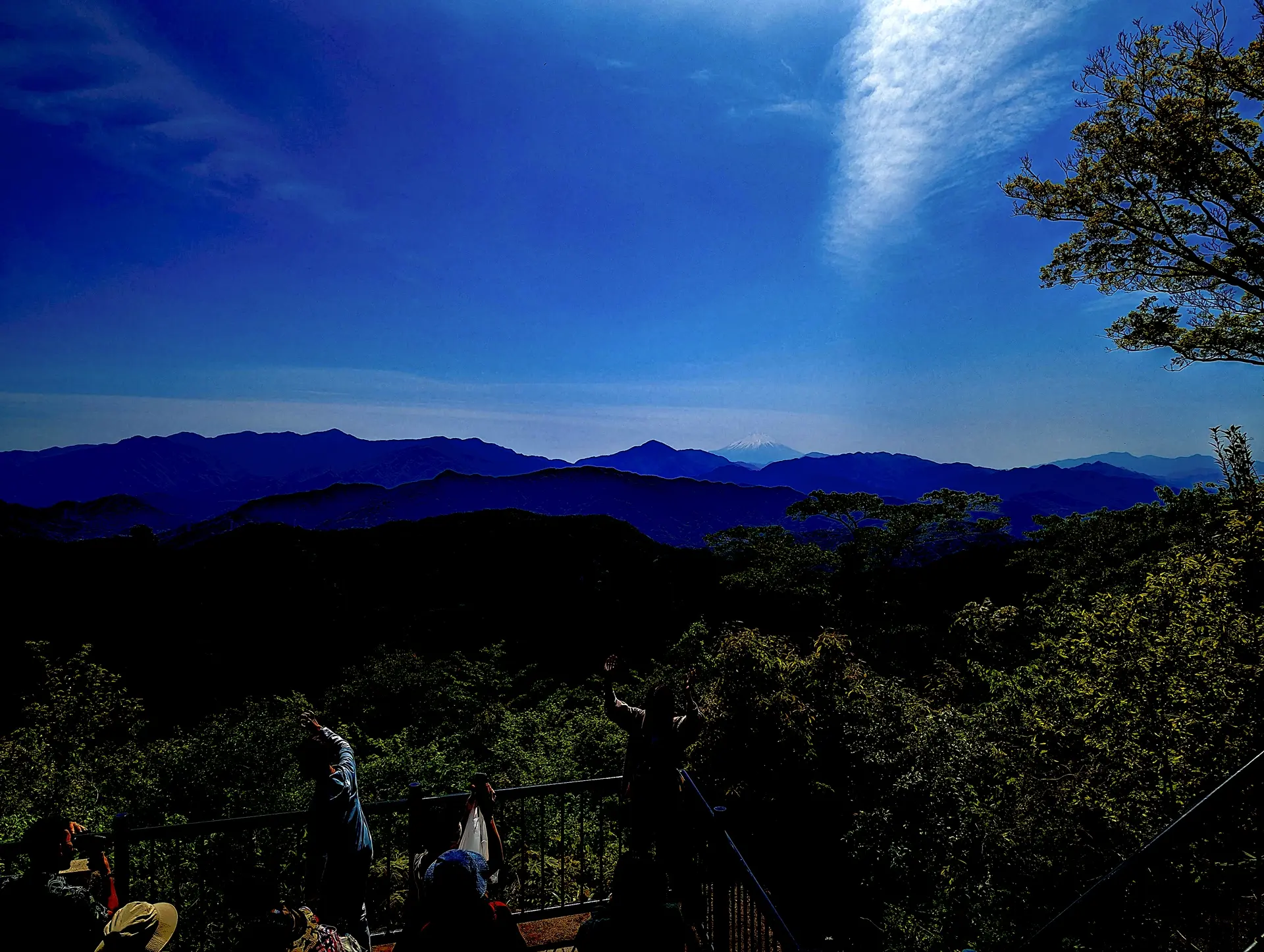
After this, I decided to take a look at the fruits of my sojourn, the nice view.
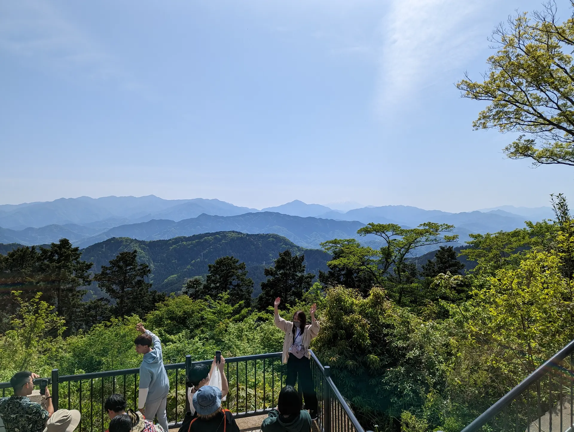
It was a really nice view but I was hoping that I would be able to see Mt. Fuji a little better. Oh you hadn't realized Fujisan was in that photograph? It's more obvious when I randomly change some sliders in the color editor!
After a totally normal amount of time spent admiring the view, I decided to head back down the mountain. Rather than go back down the same way I came up, I decided I would take one of the other trails that weren't paved. Originally I had wondered if that would be OK since if I got hurt if I was alone, it would be a big problem (in hindsight, I think cell service was probably good enough to call in an emergency). But since it was so busy, I felt that if i did trip and break my femurs or something, someone would find me within minutes.
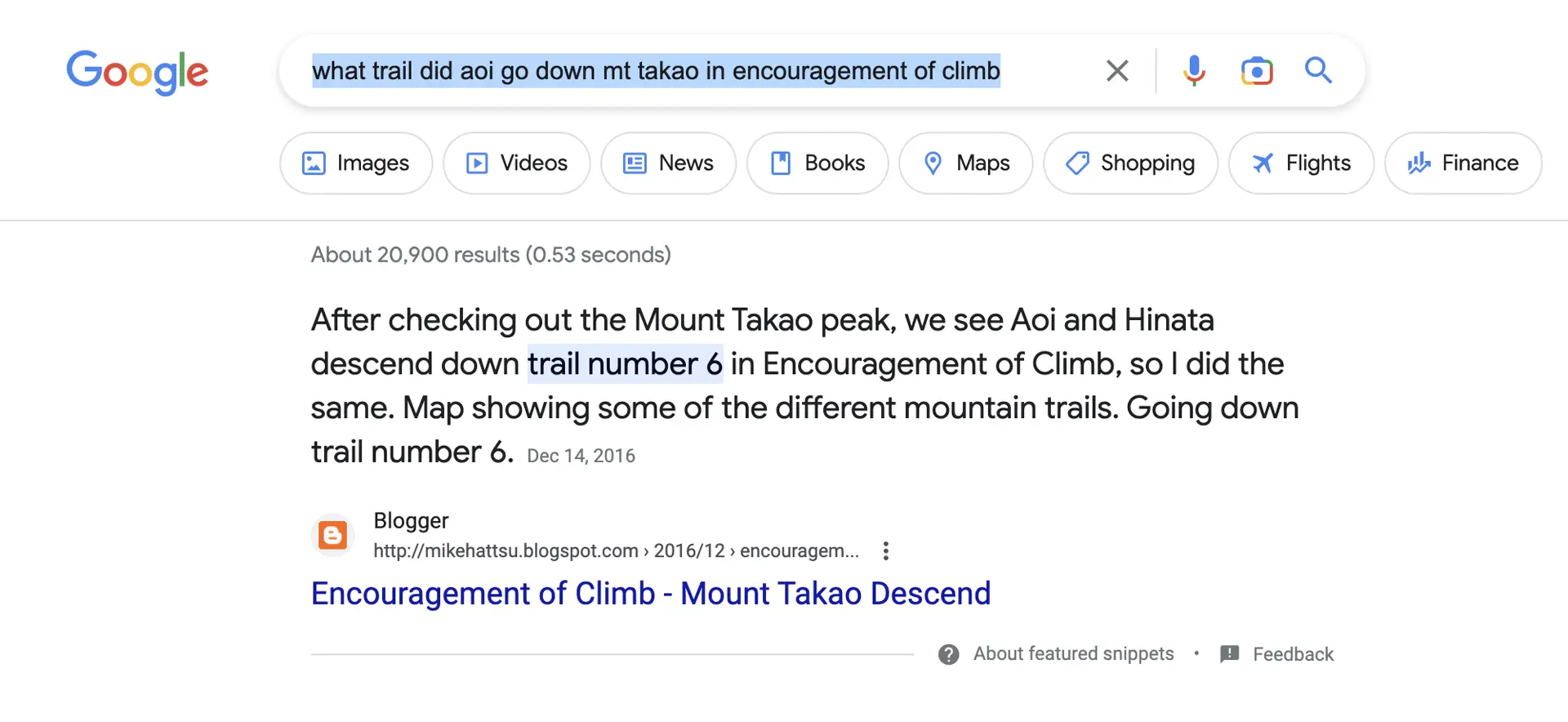
With that determined, I decided to go down via the the Inariyama trail. The main reason for this, and I realize how stupid this is, is because ChatGPT had assured me that Aoi and company descended via this trail in Encouragement of Climb. Because the hike took place over many episodes in the anime, I decided to not fact check this at all. I realized after not too long that I had been tricked, swindled. It's my fault though, because I could have done a quick search and figured it out.
 Google took original info from here
Oh well.
I started to head down a bit too late and got stuck behind two school groups. Since they were taking a safe, leisurely pace, I planned to overtake them as soon as I could. However, the portion of the route closest to the summit is a narrow set of stairs for quite some time.
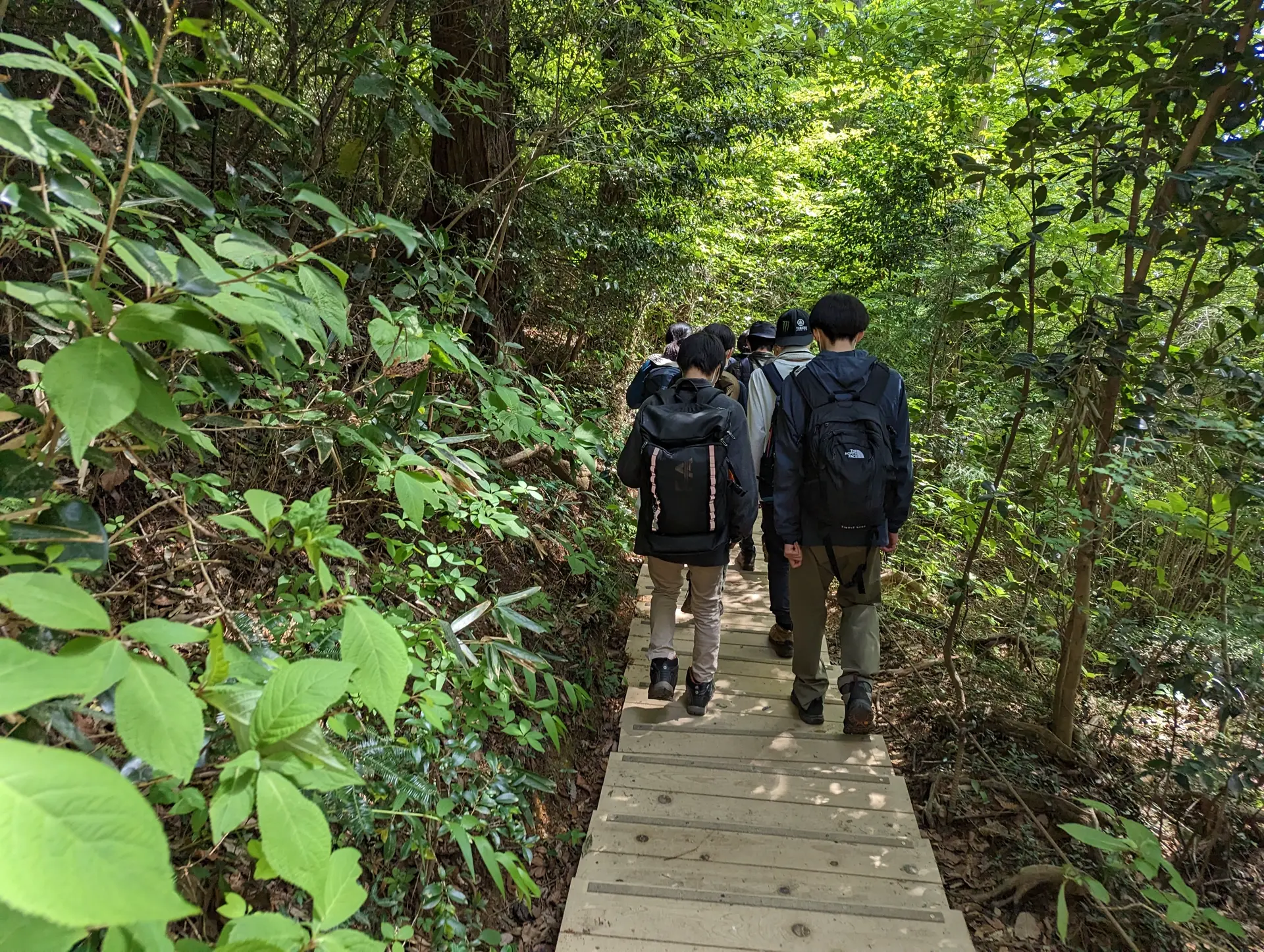
After the path leveled out a bit, I was able to overtake them and only encountered a few hikers going up or down from then on. I think that this hike would be a lot harder on the way up so probably a lot of people take a different route up and take this one down, if I had to guess. I think I only passed like 10 people coming up this way.
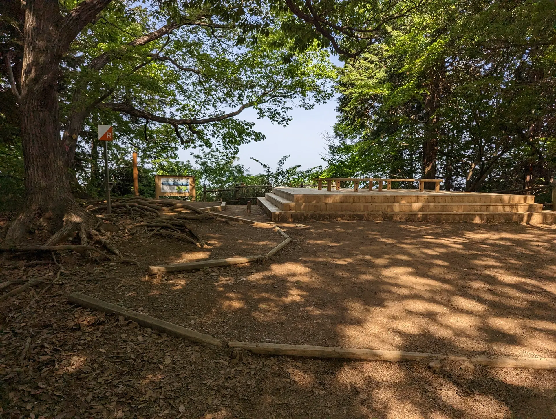
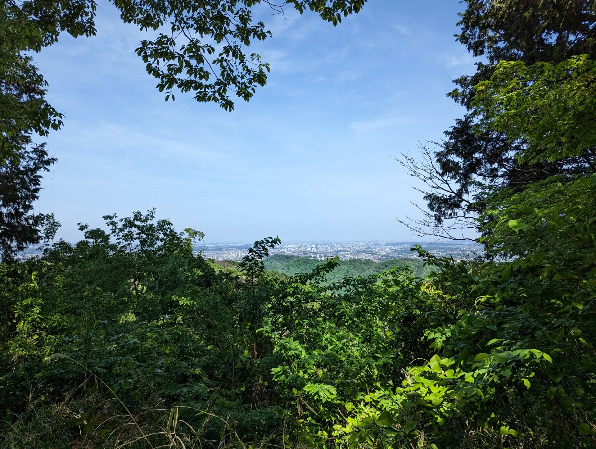
After a bit of time, I came to the Mount Inari Observation Deck, which I think technically marks the summit of Mt. Inari. Summit or not, it was just a quick place I could sit down and drink some Aquarius and have some baumkuchen. No real food for me today, only sweets. I did check out the view from this deck and it faces towards the city so you get a view of that instead of mountains.
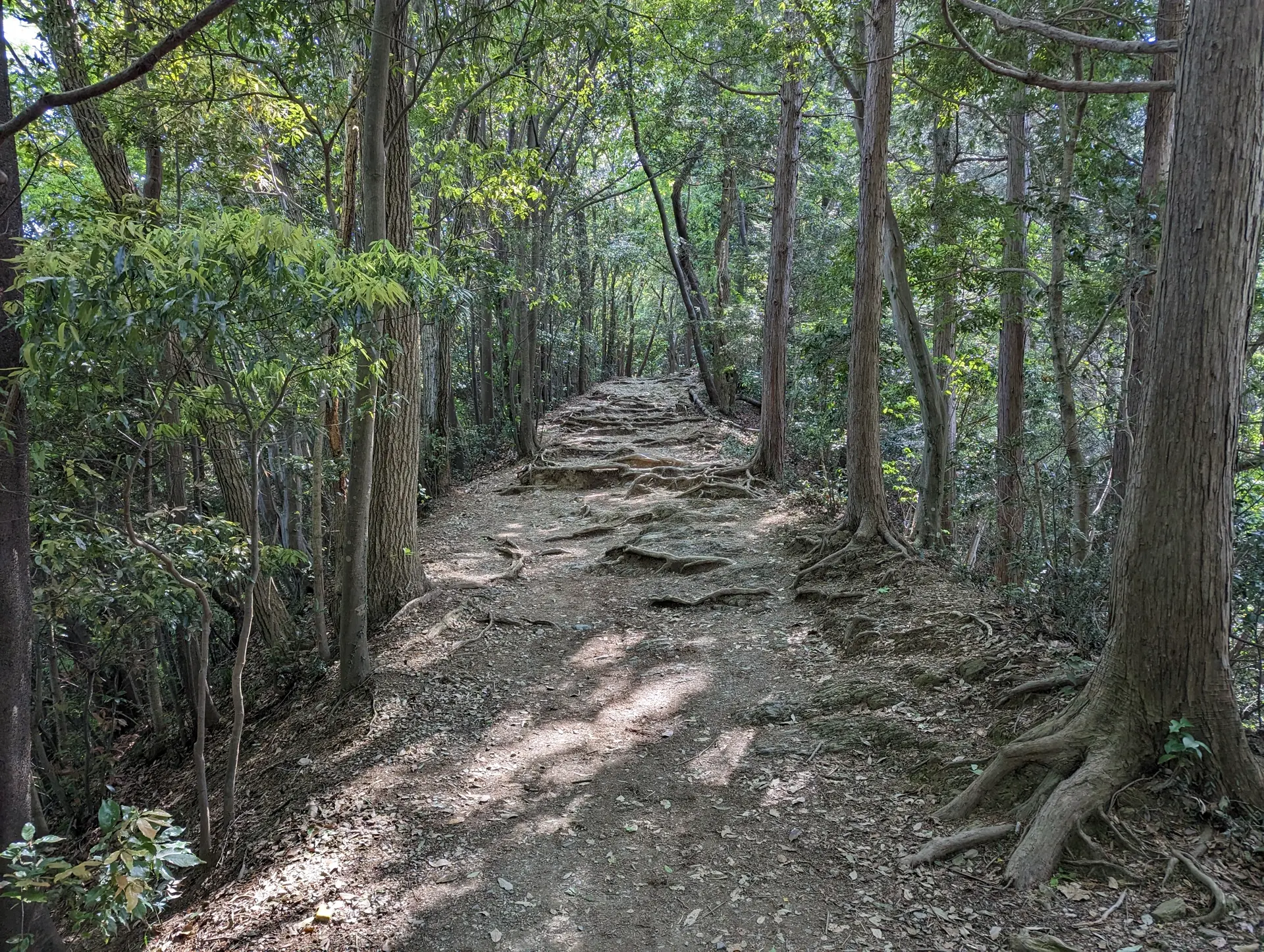
The trail from here on alternated between the wooden stairs and un-staired sections. The main reason I usually like wearing my hiking boots is because it helps my out my ankles from getting super sore or rolling my ankles entirely. Some of the wooden stairs were actually kind of wobbly, and IDK if related or not but my knees were actually what started aching. The sections without stairs were pretty cool and most of them had tons of exposed roots
At once point where it transitioned between stairs and no stairs, I actually did roll my ankle. Luckily i caught myself before I fell and it didn't seem to be sprained. Even more luckily, no one was around to see me perform my elegant maneuvers. There were markers every once in a while saying how far you had left to go, which I thought was nice. I don't know if I've actually seen that any trails before, but I'm not like an avid hiker.
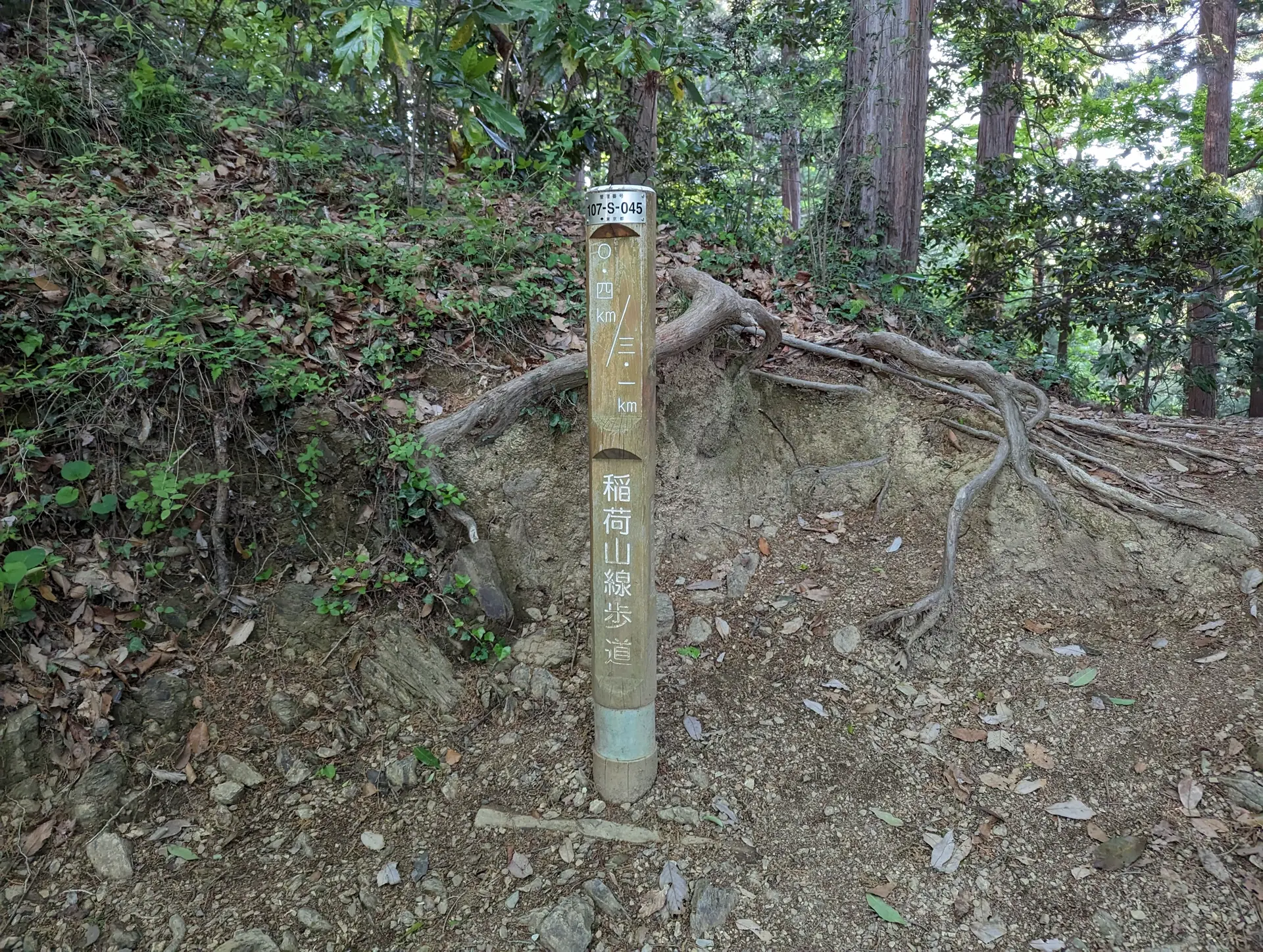 Only .4km to go!
I made it back down shortly after with no more incidents!
I stopped by the cable car station to grab another drink and go to the restroom before my 1.5 hour train ride back home.
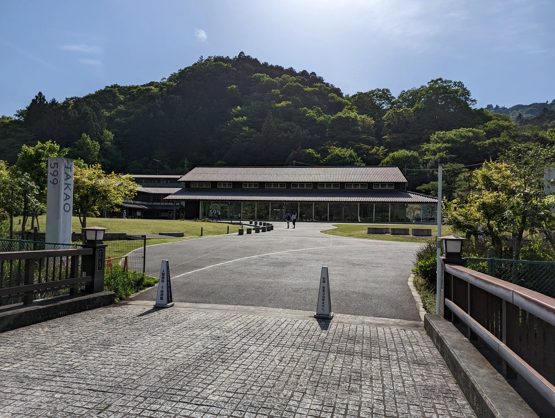
I had planned to just go back to the station and leave but figured I would probably never come back again so I should check out the TAKAO 599 Museum as well.
The building itself looked pretty modern to me. It had a cafe inside and wasn't super busy considering the number of people I had seen hiking up and down. Seems like it would be a pretty good place to hang out and have some coffee. I didn't because it was already like 3PM but I could have.
It had some cool exhibits, some informational ones, and some creepy bug ones. I think I remember one of them saying something like there are more types of plants on Mt. Takao than there are in the UK or something. IDK if that was the fact but I remember thinking that they were throwing shade. Definitely look that one up if you are interested and don't believe me on it.
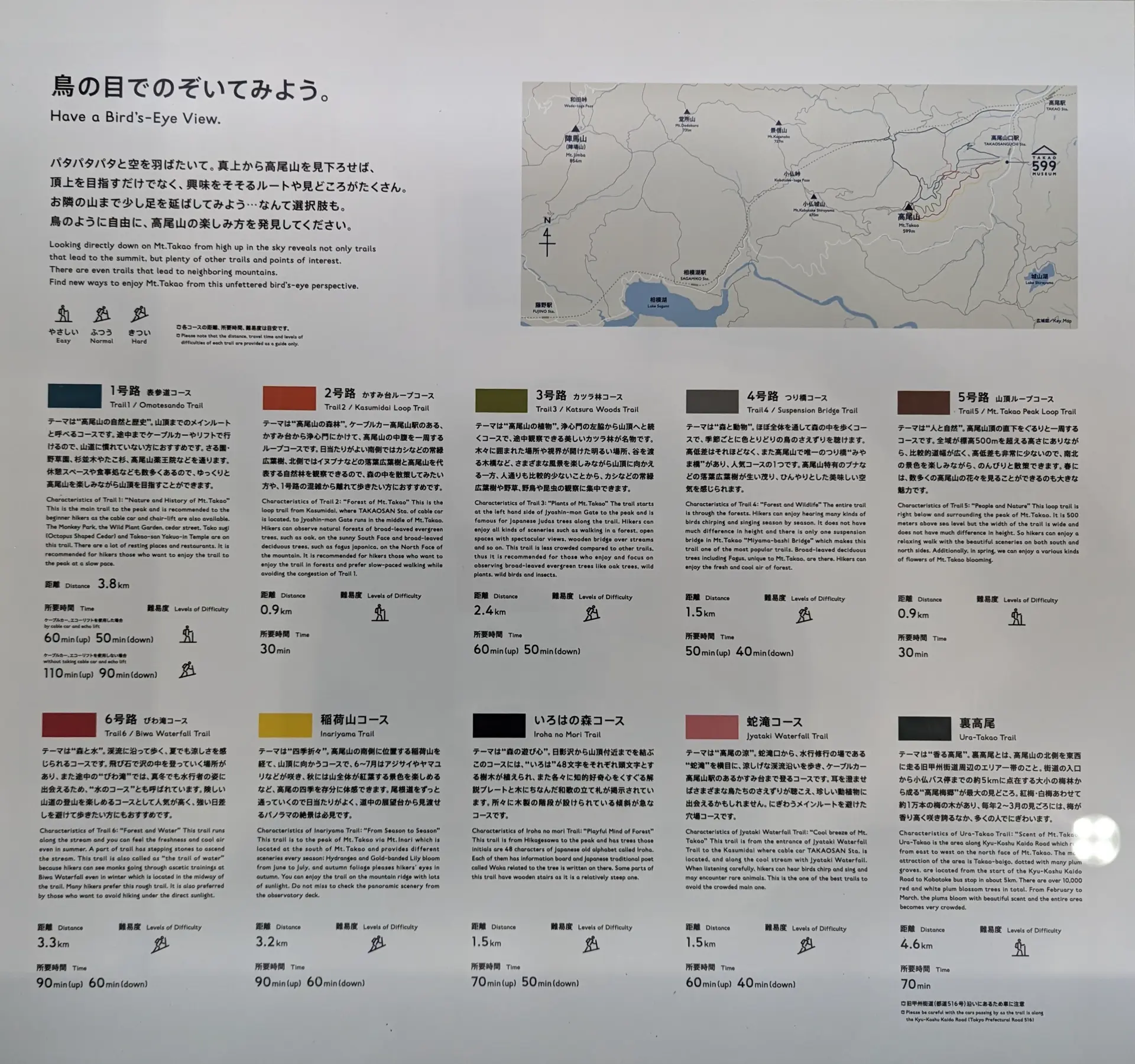
One of the more informational exhibits talked about each features of each trail. I should have stopped here before hiking up!
After filling up on knowledege, I headed to the station and went home. All-in-all I think I was on the train for about as long as I was on the mountain. If I were to go again and finish hiking up so early, I think I would also do part of the Takao-Jimba trail. Since that one is 7.8 kilometers, I'd have to come very early to do the whole thing and back if I wanted to hike there and back.